Why are minefield maps provided by Armenia to Azerbaijan inaccurate? - INTERVIEW with UN rep
- 29 January, 2025
- 04:17

Armenia has handed over 972 maps of mined territories, previously under occupation, to Azerbaijan, reads a statement by Azerbaijan's Ministry of Foreign Affairs.
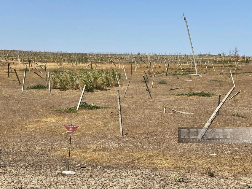
However, according to specialists from the Azerbaijan National Agency for Mine Action (ANAMA), the maps proved to be inaccurate, unreliable, and incomplete. For instance, the accuracy of maps handed over by Armenia in 2021 for the Agdam, Fuzuli, Jabrayil, and Zangilan districts was only 25%.
Why are the maps incomplete? Is Armenia deliberately refusing to provide accurate data, or are there other reasons?
UN Mine Action Service (UNMAS) representative Lee Woodyear answered these questions in an interview with Report.
According to Woodyear, after the war ended, UNMAS actively participated in negotiations regarding the transfer of mine maps to Azerbaijan, conducted assessments of mined territories, and recommended that the UN Development Program (UNDP) support Azerbaijan's demining efforts. The organization also established contact with Armenia to obtain the maps.
"Unfortunately, I don't have detailed information about these negotiations. I remember that the transfer of maps was discussed as part of the peace process, after which UNMAS completed its mission in the region, and UNDP continued the work. I've heard about problems related to map inaccuracies, but I don't have specific data," he noted.
Speaking about possible causes of inaccuracy, Woodyear emphasized that similar problems occur in other countries:
"Maps are necessary for effective demining. Servicemen create them to know the exact location of mines after the end of hostilities. However, during war, under severe stress, it's difficult to expect high accuracy from those who plant explosive devices," explained the UN representative.
Among possible causes, he also noted natural factors such as rain, floods, and landslides that can shift mines from their original locations. Additionally, the human factor cannot be ruled out - the losing side might have intentionally altered the data before handing it over.
"Experience shows that the human factor plays a key role in map accuracy. We always hope that maps will be as accurate as possible, as this minimizes losses and speeds up the demining process. Modern mines are equipped with GPS trackers, which significantly simplifies determining their location," Woodyear added.
Author